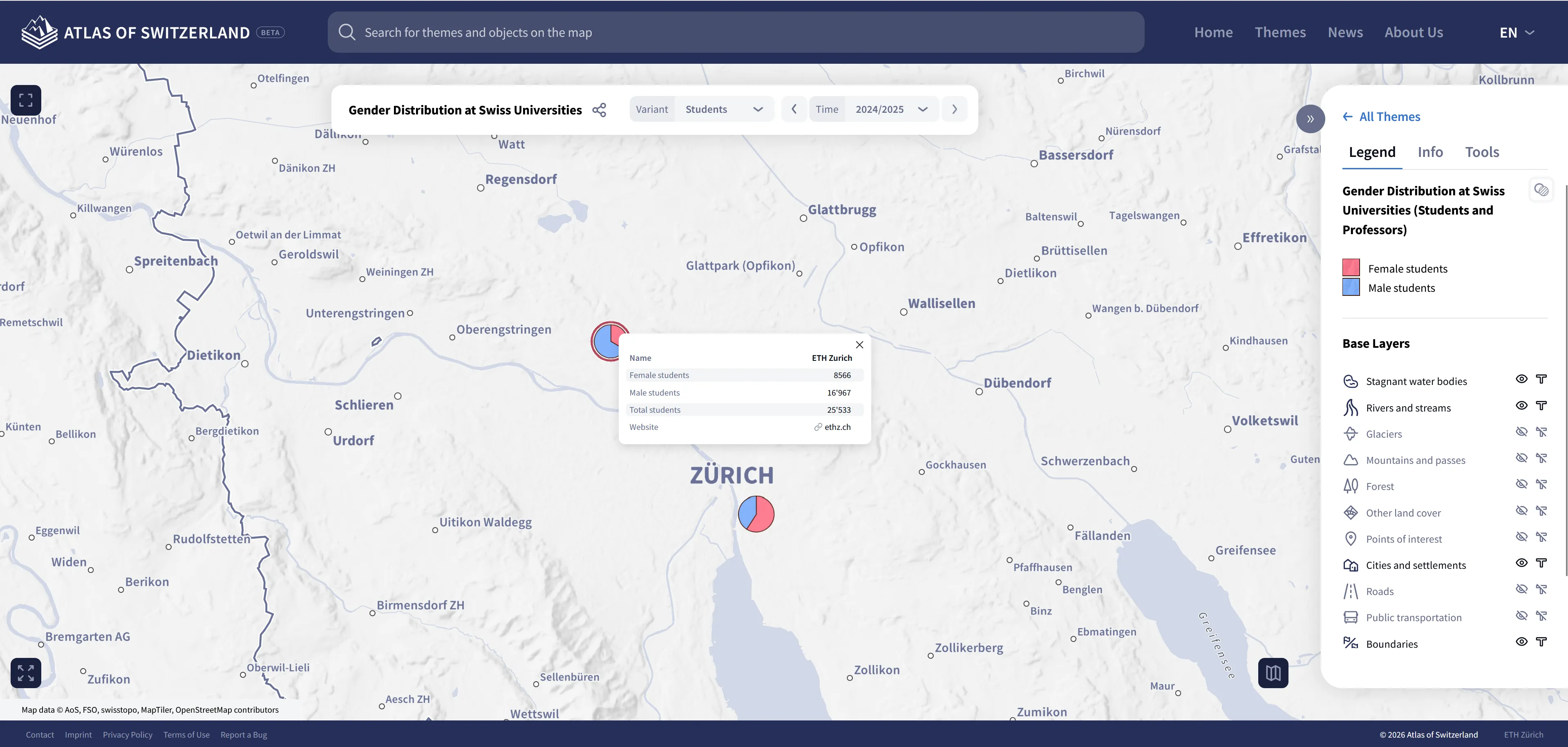
Numerous technical improvements have also been implemented. The range of map types supported by the web version is constantly growing – diagram maps are now supported too.
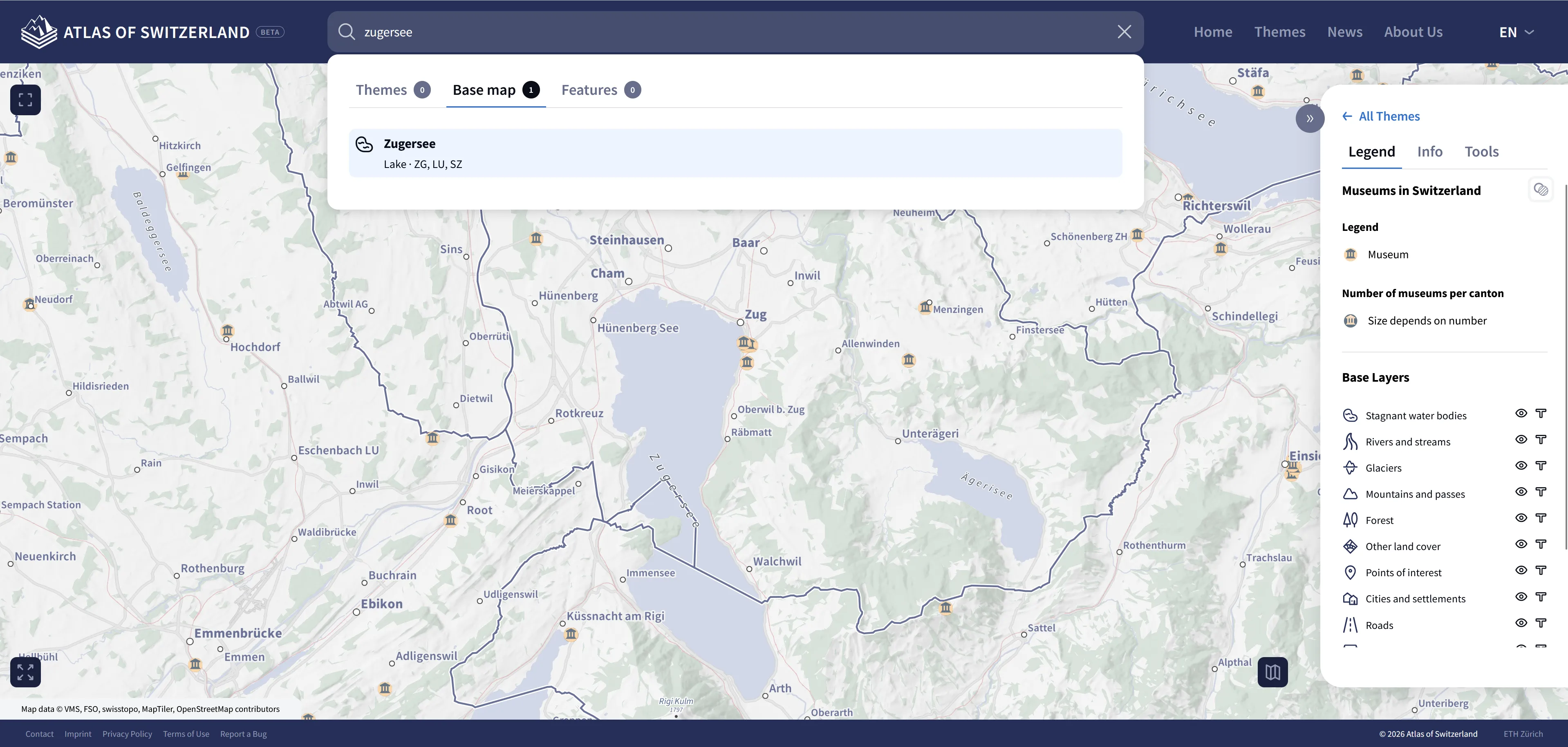
The search function has also been significantly enhanced, enabling users to search specifically for map topics and find spatial elements such as mountain peaks, rivers, lakes and municipalities on the base map. Users can also search for individual thematic objects within a selected thematic map. Base map searches are based on the swisstopo API, while topic and object searches rely on a custom search index. The topic search uses a context-based approach to return results for related terms, known as a semantic search.
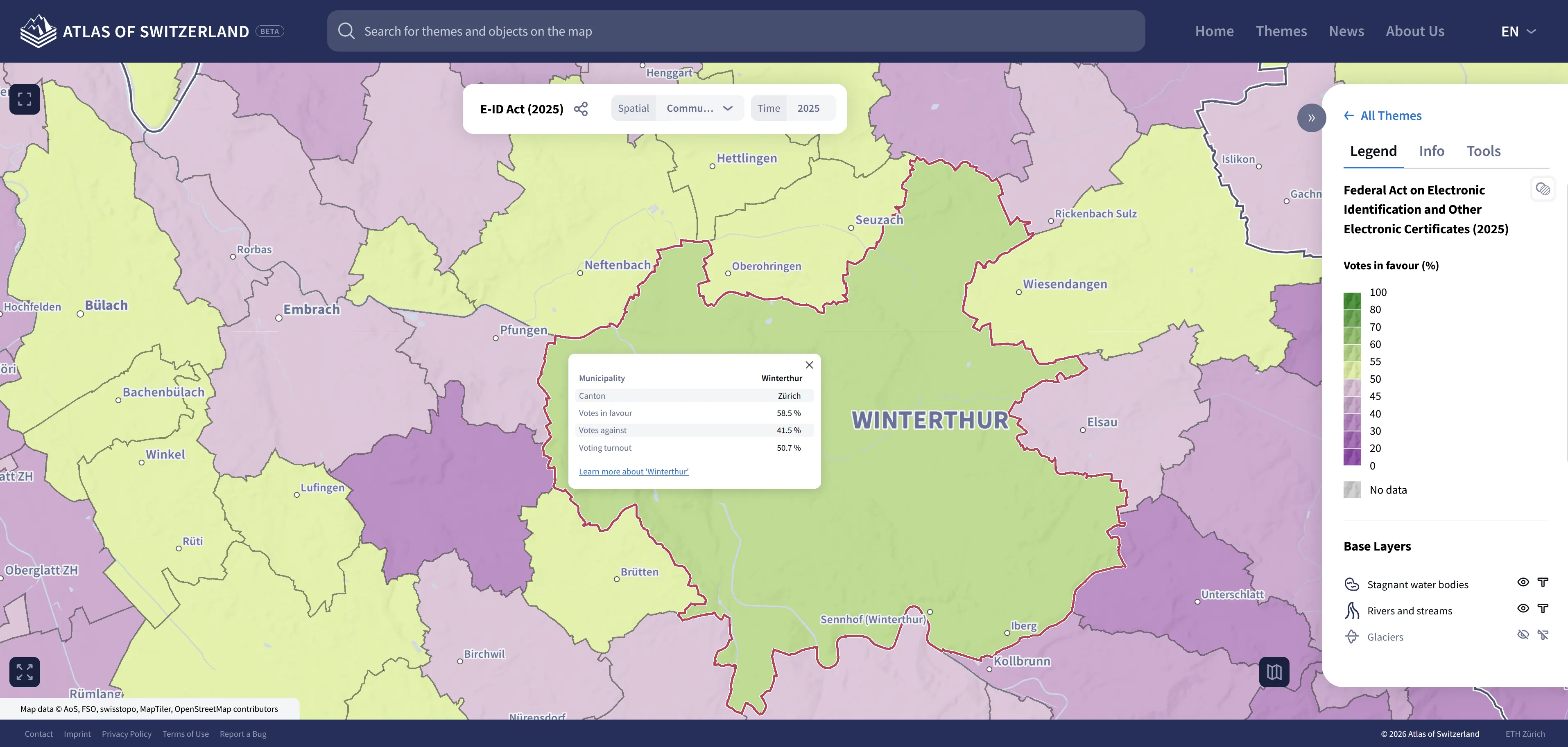
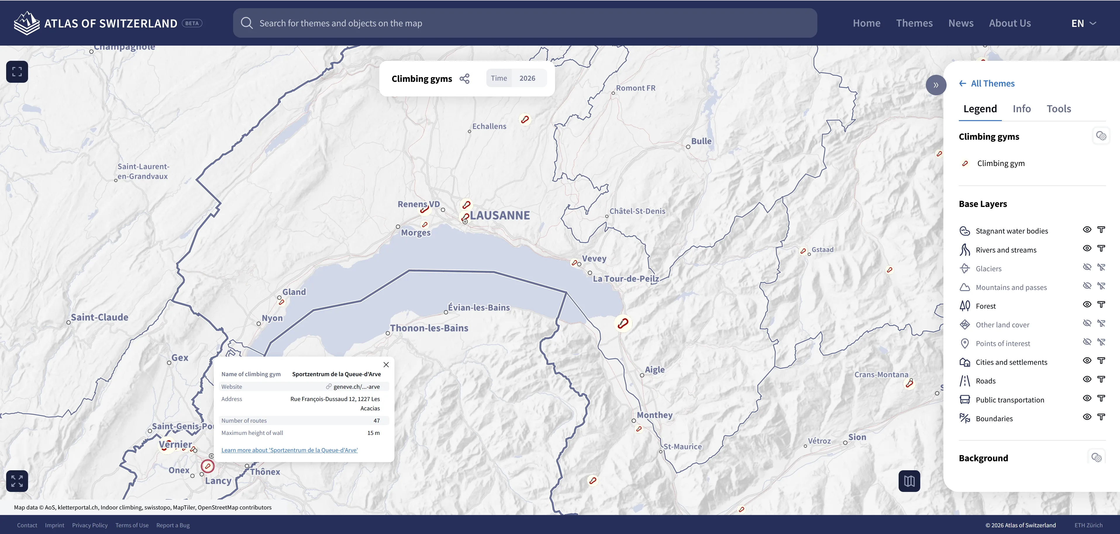
When interacting with the map, newly selected objects are highlighted with an outline. A dark red colour with a subtle white halo is used to ensure good visibility across all contexts (different base map styles and thematic representations). Selected icons, diagrams and polygons are now displayed with an outline instead of a point or full-area fill.
Map rendering has also been optimised. Transitions when switching maps (e.g. during time navigation) are now seamless without any white flashes or interruptions, resulting in an improved user experience.
Thanks to the new web version, the Atlas of Switzerland can now be used on mobile devices too. In the first few months, valuable experience has been gained in visualising an atlas on mobile devices, which presents particular challenges. The user interface has been revised several times to provide more space for cartographic content.
The homepage has been redesigned to highlight the most important features of the atlas at a glance and provide quick access to the maps.
Alongside technical progress, substantial editorial work has been carried out.
The number of maps available in the web version is steadily growing, with more than a third already successfully migrated. Maps that have not yet been transferred to the web version remain available in the desktop version and can be accessed via direct links on the website. The migration process is ongoing.
Several existing maps have been updated. For instance, the map of Swiss flag bearers at the Olympic Games has been updated to include the Milano Cortina Olympic Games. Various maps for adventurous users, such as those showing rope parks, climbing gyms and via ferratas, have also been revised. Additionally, the maps on coffee producers and boccia facilities in Switzerland have been updated.
New content has also been added to the atlas, including a map showing the development of the number of professors, academic staff and students at Swiss higher education institutions, focusing on gender distribution. Another new map covers components of the natural water balance, such as precipitation, evaporation, runoff and storage, in the field of hydrology.
At the end of March, we presented a talk on the new version of the Atlas of Switzerland at the FOSSGIS Conference in Göttingen. You can find the video and the slides of the talk here.
In April, the Atlas of Switzerland was presented at the Mountain Cartography Workshop in Harrachov, Czech Republic, focusing on topics relevant to mountain regions.
If you would like to learn more about the Atlas of Switzerland, there will be further opportunities soon:
- On 5 May 2026, we will present the Atlas of Switzerland at the GeoTreff event for geography teachers at ETH Zurich.
- On 28 May 2026, we will give a talk at the German Cartography Congress in Dresden.
The coming weeks and months will be an exciting time for the Atlas of Switzerland, with further maps being migrated, new content being published or updated, and additional features being developed.
Do you have any feedback or suggestions for improvement? We welcome any input. Please feel free to use our contact form or the ‘Report Error’ function in the footer to get in touch with us directly.
Numerous technical improvements have also been implemented. The range of map types supported by the web version is constantly growing – diagram maps are now supported too.
The search function has also been significantly enhanced, enabling users to search specifically for map topics and find spatial elements such as mountain peaks, rivers, lakes and municipalities on the base map. Users can also search for individual thematic objects within a selected thematic map. Base map searches are based on the swisstopo API, while topic and object searches rely on a custom search index. The topic search uses a context-based approach to return results for related terms, known as a semantic search.
When interacting with the map, newly selected objects are highlighted with an outline. A dark red colour with a subtle white halo is used to ensure good visibility across all contexts (different base map styles and thematic representations). Selected icons, diagrams and polygons are now displayed with an outline instead of a point or full-area fill.
Map rendering has also been optimised. Transitions when switching maps (e.g. during time navigation) are now seamless without any white flashes or interruptions, resulting in an improved user experience.
Thanks to the new web version, the Atlas of Switzerland can now be used on mobile devices too. In the first few months, valuable experience has been gained in visualising an atlas on mobile devices, which presents particular challenges. The user interface has been revised several times to provide more space for cartographic content.
The homepage has been redesigned to highlight the most important features of the atlas at a glance and provide quick access to the maps.
Alongside technical progress, substantial editorial work has been carried out.
The number of maps available in the web version is steadily growing, with more than a third already successfully migrated. Maps that have not yet been transferred to the web version remain available in the desktop version and can be accessed via direct links on the website. The migration process is ongoing.
Several existing maps have been updated. For instance, the map of Swiss flag bearers at the Olympic Games has been updated to include the Milano Cortina Olympic Games. Various maps for adventurous users, such as those showing rope parks, climbing gyms and via ferratas, have also been revised. Additionally, the maps on coffee producers and boccia facilities in Switzerland have been updated.
New content has also been added to the atlas, including a map showing the development of the number of professors, academic staff and students at Swiss higher education institutions, focusing on gender distribution. Another new map covers components of the natural water balance, such as precipitation, evaporation, runoff and storage, in the field of hydrology.
At the end of March, we presented a talk on the new version of the Atlas of Switzerland at the FOSSGIS Conference in Göttingen. You can find the video and the slides of the talk here.
In April, the Atlas of Switzerland was presented at the Mountain Cartography Workshop in Harrachov, Czech Republic, focusing on topics relevant to mountain regions.
If you would like to learn more about the Atlas of Switzerland, there will be further opportunities soon:
- On 5 May 2026, we will present the Atlas of Switzerland at the GeoTreff event for geography teachers at ETH Zurich.
- On 28 May 2026, we will give a talk at the German Cartography Congress in Dresden.
The coming weeks and months will be an exciting time for the Atlas of Switzerland, with further maps being migrated, new content being published or updated, and additional features being developed.
Do you have any feedback or suggestions for improvement? We welcome any input. Please feel free to use our contact form or the ‘Report Error’ function in the footer to get in touch with us directly.