Export Function and Feature Search – June 2026
The Atlas of Switzerland offers two new, important features: maps can now be exported as PDF or PNG files. Within the selected maps, you can search for specific objects (e.g. a museum on the museum map).
June 19, 2026
Export Function
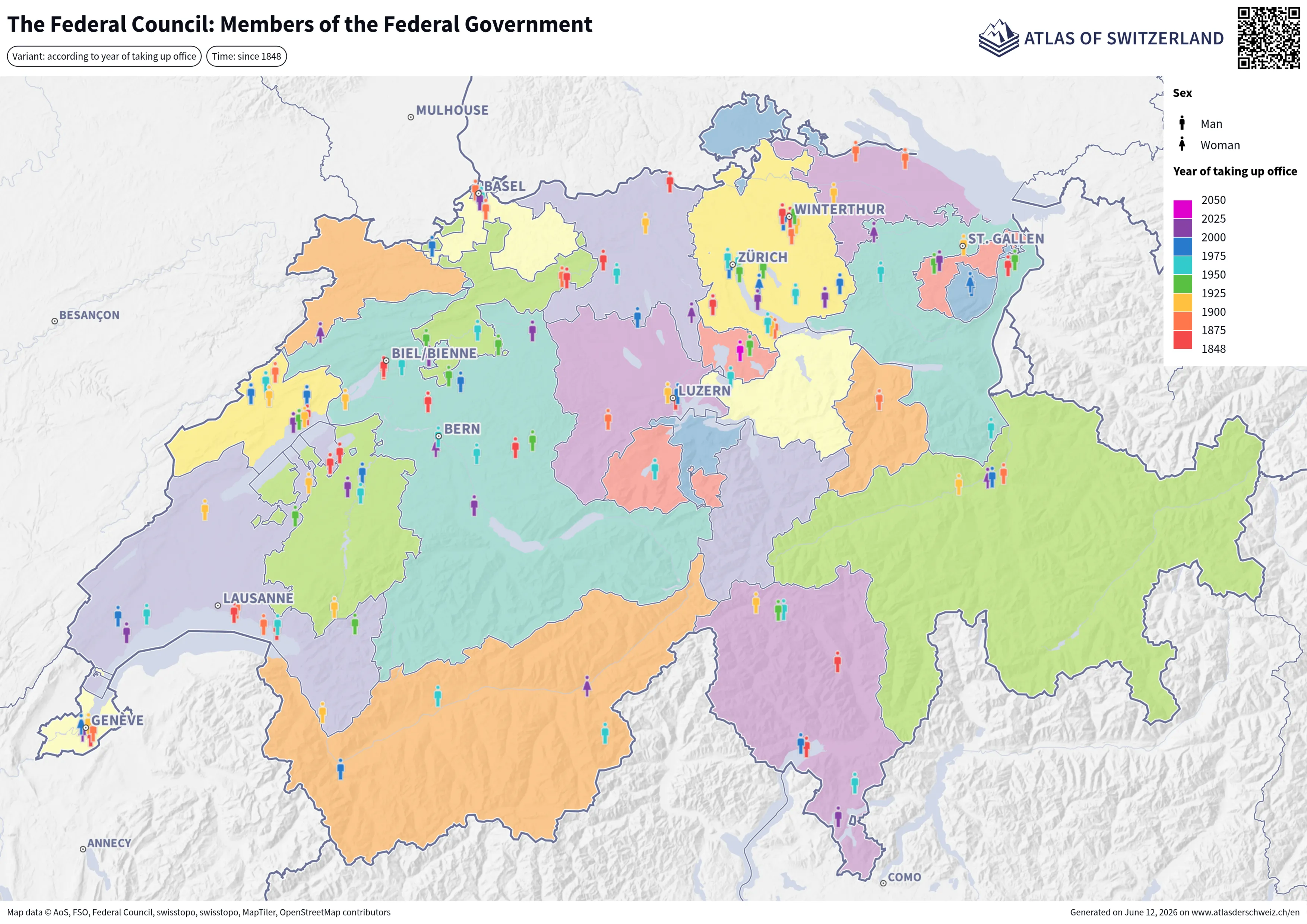
Would you like to embed a map from the Atlas of Switzerland as an image in a PDF document or print it out directly? Thanks to the new «Export map» feature, this is now very easy to do.
Maps can be exported as PDF or PNG files – in various resolutions and formats, such as A4 or A3 in landscape or portrait orientation, as well as in special formats for screens and social media. There are also various options available for customising the map’s extent.
The legend plays an important role on every map. That is why it can also be exported. Depending on the theme and map extent, the optimal placement of the legend may vary. For this reason, users have the option to decide for themselves where the legend should be positioned, whether it should be printed on a separate page or whether it should be suppressed completely.
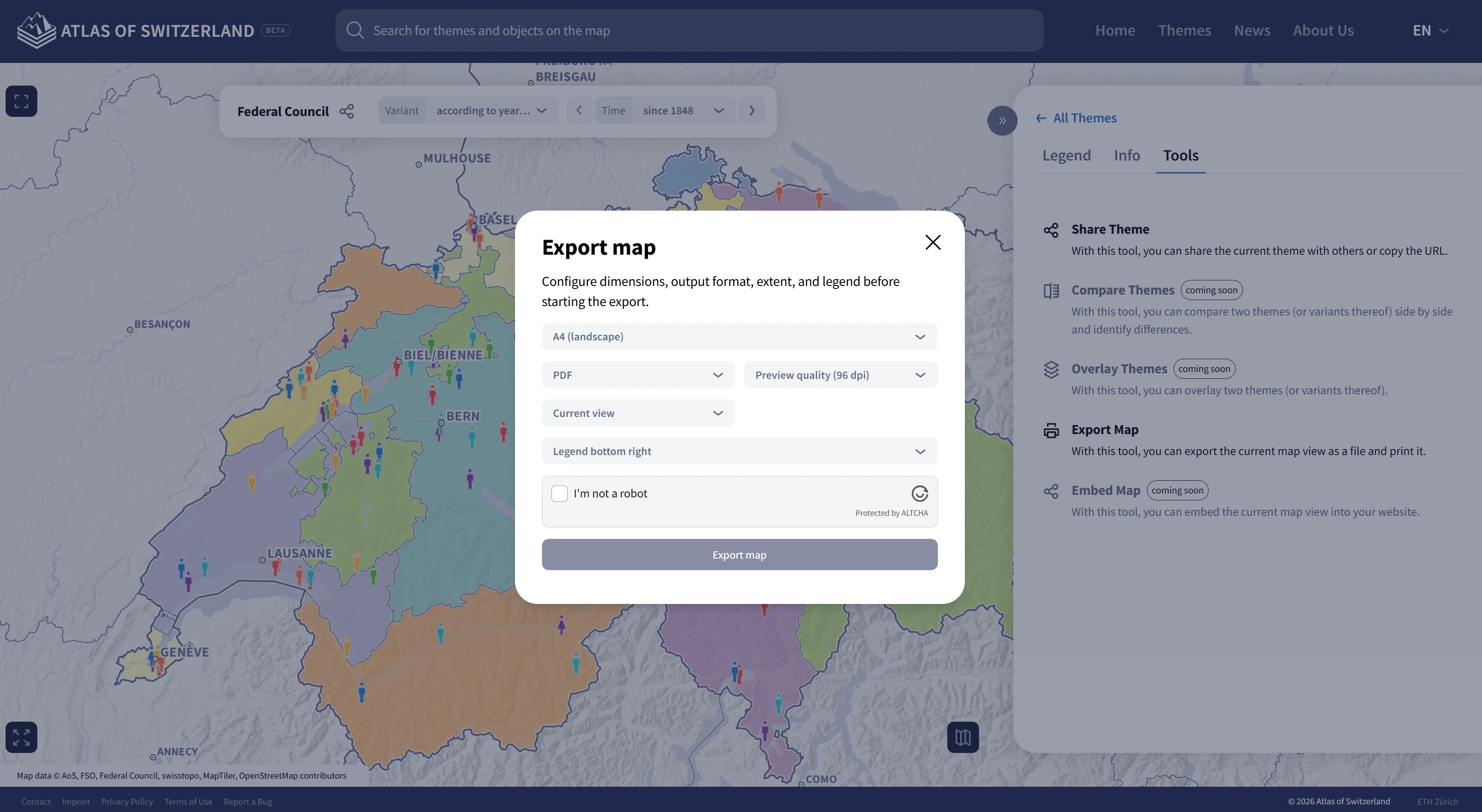
The export function can be found in the right-hand side panel under the “Tools” tab and is launched via the “Export map” tool.
The export process takes place on the server side in order to optimise the performance of this feature and to provide users with a consistent, high-quality user experience across all devices.
At the top of the exported file, beneath the map title, you will also find the selected map variant, spatial reference or time range. The QR code in the top right-hand corner allows you to open the same map electronically again.
Feature Search
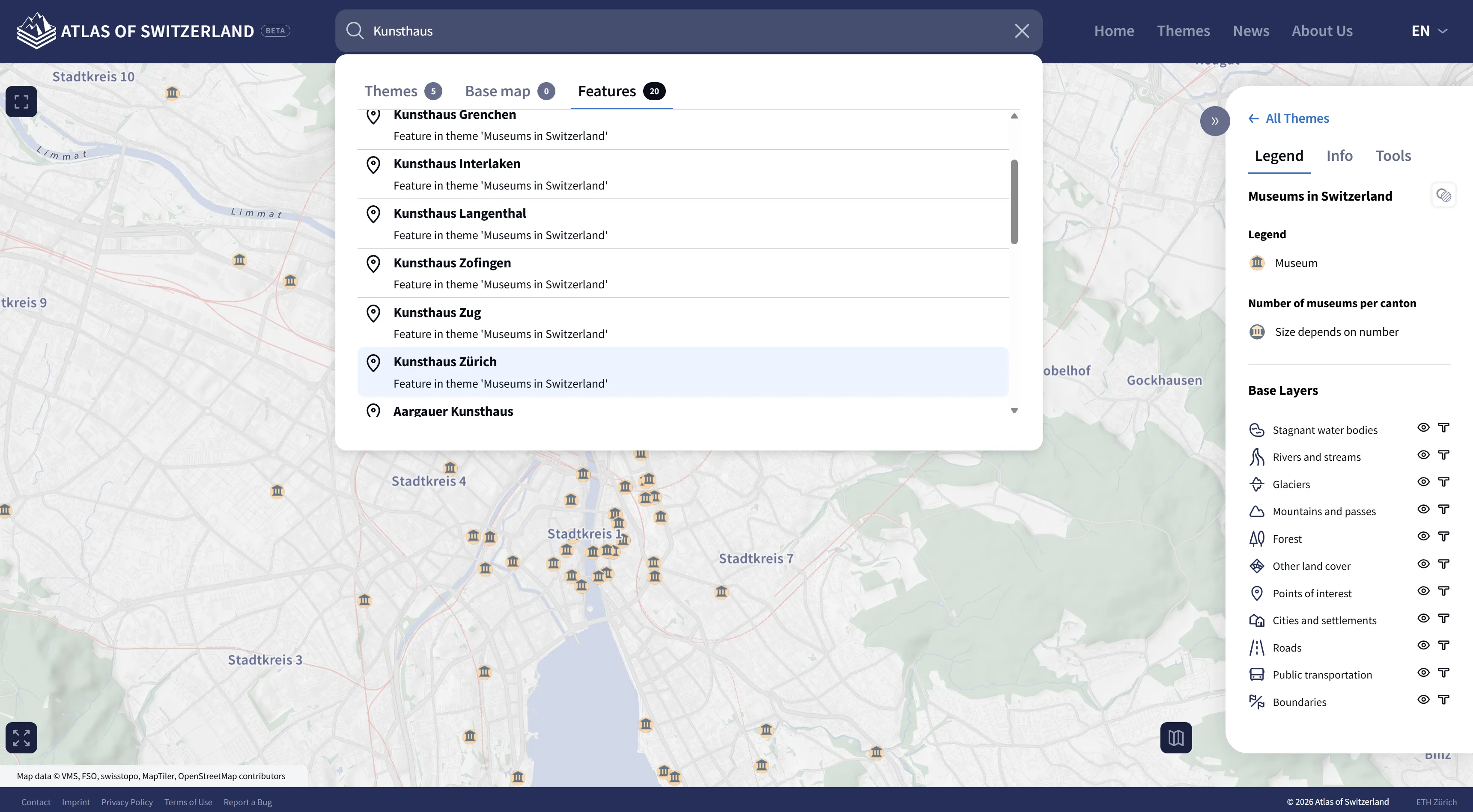
It was already possible to search for map themes and features on the base map in previous versions. Now there is also a feature search within the selected map theme. For example, if you have loaded the “Museums in Switzerland” map, you can now find the “Features” in the third tab of the search results. This allows you, for example, to find all the “Kunsthaus” (art museums) in Switzerland within the museums.
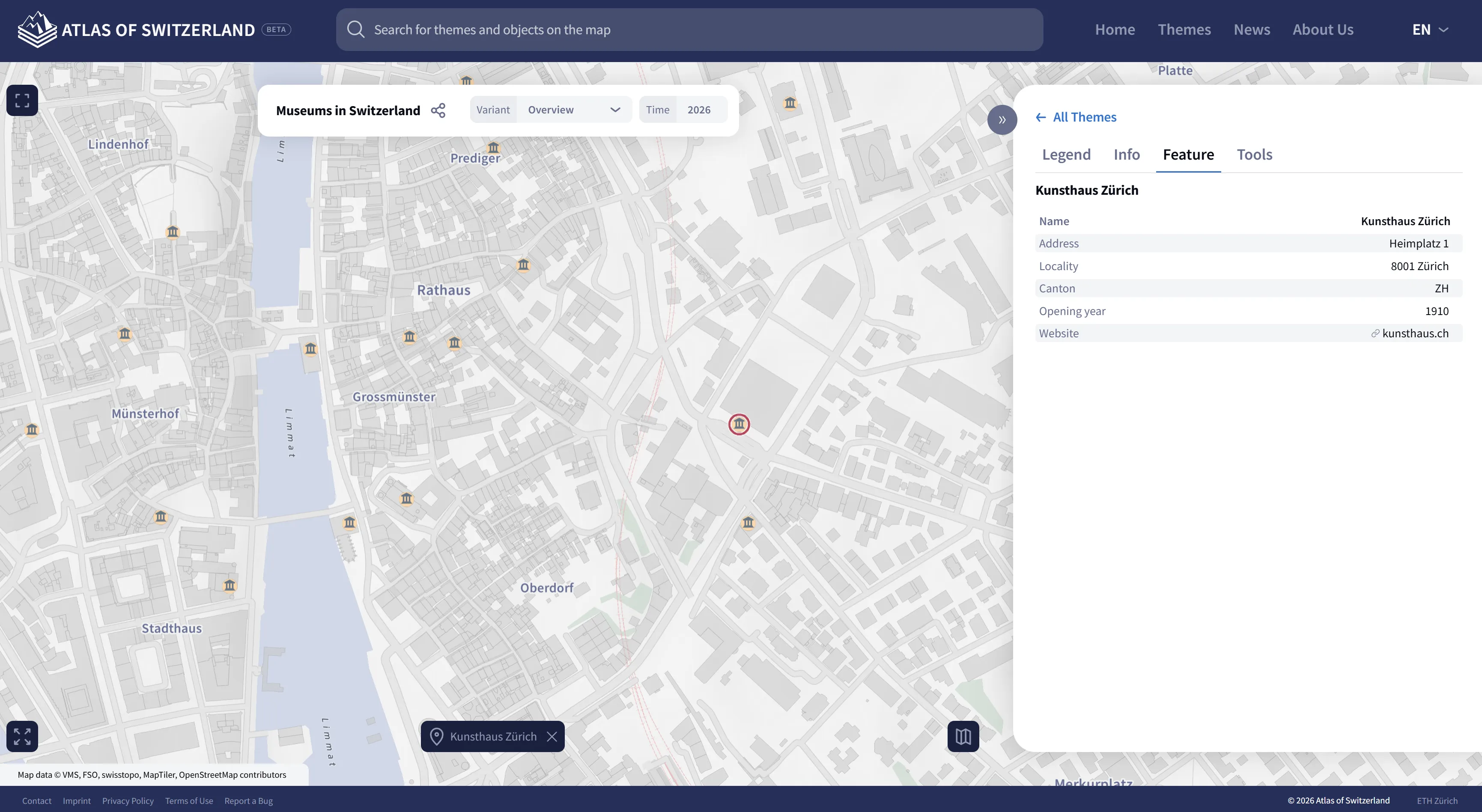
The selected object is centred on a new map extent, highlighted with a red border, and the object details are displayed in the side panel. The highlight around the selected object can be removed using the button at the bottom centre. This also hides the object details (feature panel).
An interesting map has also recently been migrated from the desktop version to the new web version: The Federal Council – Members of the Federal Government. Take a look at this map – and why not give the new export function and the feature search a try!